

Products & Services
Satellite Based Environmental Intelligence
Our products and services are designed to meet the Earth observation needs of users and decision-makers. They are aimed at public sector organisations, non-profit organisations and private companies committed to environmental protection.
Expert Advisory
Scientific & Technical Consulting
Literature Reviews
Scientific Audits
Community & capacity development
Emergency Mapping

Ice Monitoring
At Arctus, we offer advanced near–real-time ice mapping services to support safer, smarter decision-making in riverine and coastal environments.
Using Synthetic Aperture Radar (SAR) from Sentinel-1 and the RADARSAT Constellation Mission, we monitor ice day or night, in all weather conditions - tracking ice formation, evolution, breakup, ice jams, and open-water channels. When conditions allow, we complement this with high-resolution optical imagery from Sentinel-2 and Landsat for enhanced visualization and communication.
Satellite Derived Bathymetry
Technological innovation leading to knowledge advancement.
Navigation close to the coast can be risky if the presence of shoals has not been adequately mapped, or if the coast has undergone rapid geomorphological modification after the passage of a storm. We can provide Satellitle Derived Bathymetry to map the coastline even in difficult to reach locations.


Coastal Monitoring Services
Better understand ecosystems to enjoy and protect them.
We offer a coastal ecosystem mapping and monitoring service tailored to users’ needs. In collaboration with specialists from the Université du Québec à Rimouski, Arctus uses machine learning-based classification methods to classify multispectral images. These can be used to map waterline, high/low tide, shore lines, shore profiles and coastal erosion. Our coastal mapping can be used to map habitats, intertidal zones, submerged vegitation classification and seagrass mapping.
Water Quality Monitoring
Observe. Monitor. Manage. Protect.
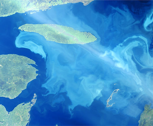
Aquatic environments are dynamic, and their spatial and temporal variability increases as they approach the coast. Thanks to R&D funding, Arctus has developed satellite data processing chains to generate near-real-time variables used as proxies for water quality, such as turbidity and chlorophyll-a concentration (linked to algal production and eutrophication).
Solutions
-
Risk Evaluation
-
Mapping and classification
-
Coastal evolution and change
-
Environmental follow-up
-
Water Quality
-
Decision making support
-
Mapping web platform
-
Training and knowledge transfer
-
Processing chains
-
Operational Biological Oceanography
